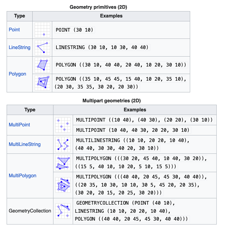
WKT or “Well Known Text” format is a standard used to describe geometric shapes and is most notably used when declaring new geometric data in PostGIS. It is commonly used for expressing locations on earth. GeoJSON is an alternative to WKT. Examples